
|
|


|

|

|

|

|

|

|
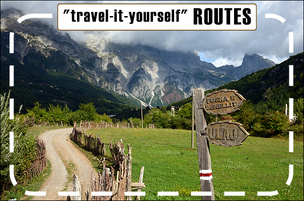
| "travel-it-yourself" routes |


| site index |
| main page |
| back |

|
|
|
|||||||||||||||||||||||||||||||||||||||||||||||||||||||||||||||||||||||||||||||||||||||||||||||||||||||||||||||||||||||||||||||||||||
|
||||||||||||||||||||||||||||||||||||||||||||||||||||||||||||||||||||||||||||||||||||||||||||||||||||||||||||||||||||||||||||||||||||||
|
ROADBOOK - WHAT IS IT?
A road book is the route description in a form of schematic images. Each square (field) of a road book presents one junction and it indicates in which direction you should go (some squares also describe places special of special interest). The stretches between junctions represented in subsequent squares lead along the main road as indicated by the road signs. IT IS VERY IMPORTANT!!! : it means that when you get to a junction and it is not described in the road book, you should proceed along the main road; if the main road turns left, you also have to turn left; if you travel on a two-lane road (for example, in Prague) and one of the lanes branches, you should go along the left (main) lane (internal). Sometimes distances between subsequent squares can be several dozen kilometres, so if you miss one junction, then you may lose a lot of time. All squares in the road book are described with numbers and signs. The road book includes a legend of all signs. The squares have a number reference in the top left corner - that is the subsequent number of the square. In the top right corner there is the reference to the waypoint number corresponding to the given square in the GPS file. In the middle, at the top of the square, there is information about the distance from the previous square; it is given in meters with accuracy of 50 meters (according to GPS indications; remember: standard car meters usually give slightly higher values). There are many standards of making road books. The way described above is one of the most popular and the easiest. For example, the POZNAN-PRAGUE route includes over 220 squares for navigation, which are included on 9 A-4 size pages. Write, if you need more information. |
||||||||||||||||||||||||||||||||||||||||||||||||||||||||||||||||||||||||||||||||||||||||||||||||||||||||||||||||||||||||||||||||||||||
|
||||||||||||||||||||||||||||||||||||||||||||||||||||||||||||||||||||||||||||||||||||||||||||||||||||||||||||||||||||||||||||||||||||||


")


